Ad Daqahliyah: region in Egypt
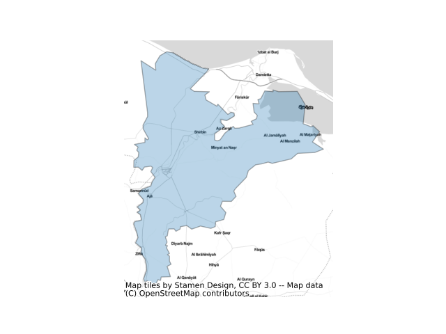
What exactly constitutes the spatial extent of the city? For these aggregations, we used the Global Human Settlement Layer Urban Center Database (GHS-UCDB) to define the boundaries of the city. These cities -- or urban centers -- cover areas that are densely populated and built-up, and so may extend beyond the spatial borders of these cities that we may be familiar with. The GHS area is shaded in blue.
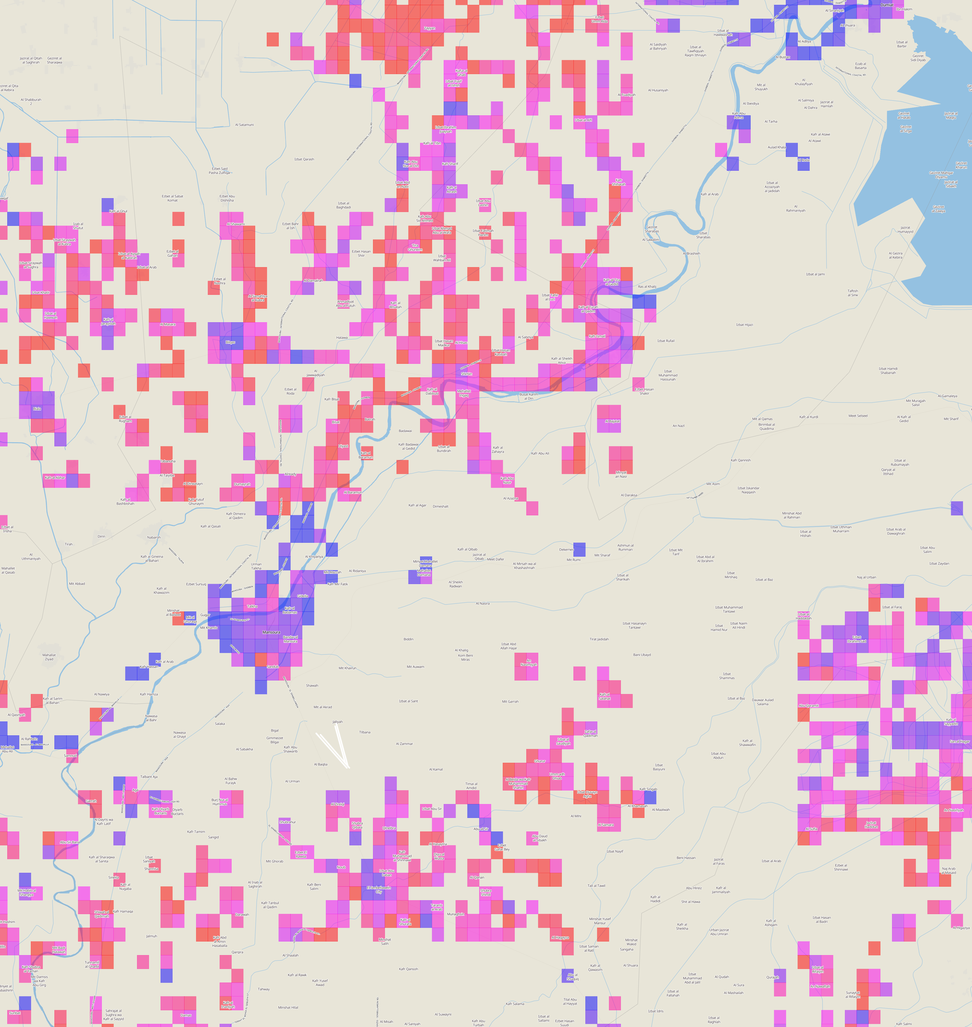
View Ad Daqahliyah, Egypt on the sprawlmap
Most recent snapshot: Taking into account the entire (i.e. aggregate) street network in Ad Daqahliyah as of 2014, the overall level of street-network sprawl is 3.48, which is highly disconnected.
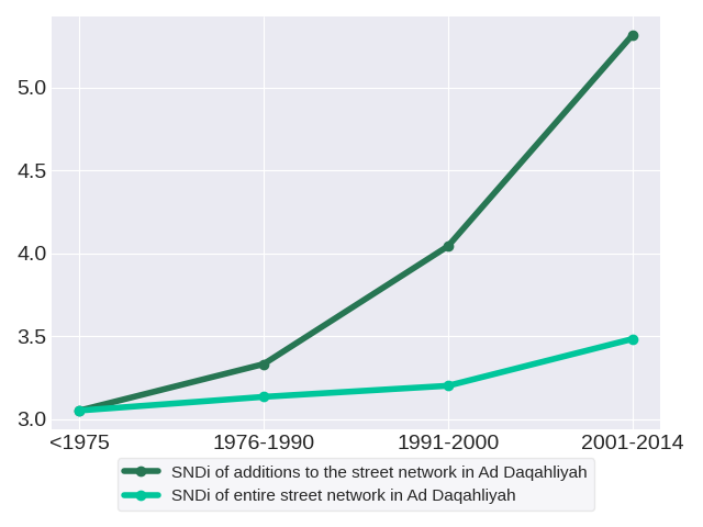
Trends in street network construction: The SNDis of street construction for the respective time periods are 3.05, 3.33, 4.04 and 5.32. In each period, new street development in Ad Daqahliyah steadily grows more disconnected than in the last.
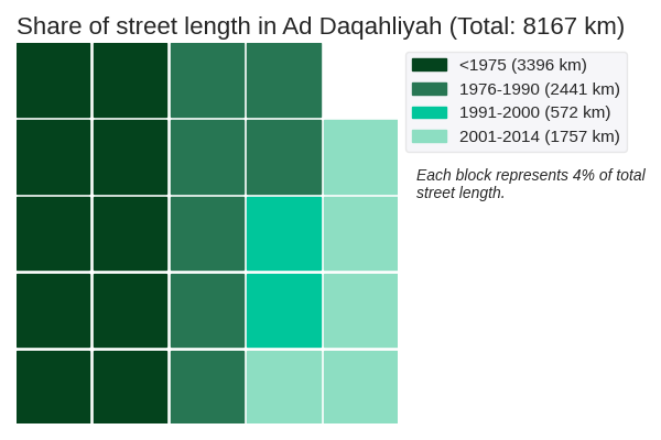
Quantity of street network construction: The street network in Ad Daqahliyah spans a total of 8167 kilometers. It is dominated by roads constructed prior to 1975. These roads have an SNDi of 3.05, which is in the 40th to 60th percentile of disconnectedness.
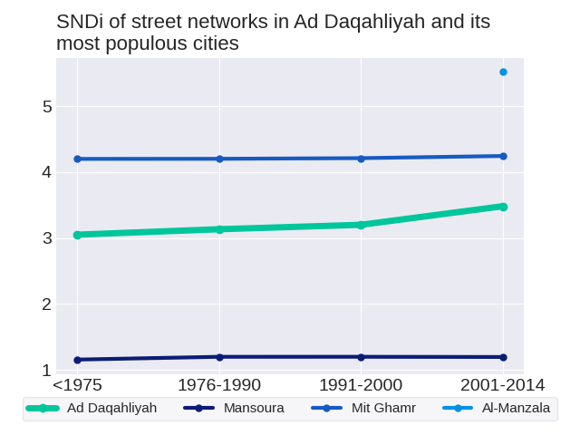
Effect on the aggregate network: New construction in each period adds to the total stock of streets, but does not change streets that have already been built. Therefore, it has a limited effect on the street network as a whole. The SNDis of the aggregate street network in the respective time periods are 3.05, 3.13, 3.2 and 3.48. Overall, the SNDi of the aggregate street network has risen: the street network in Ad Daqahliyah has become more disconnected.
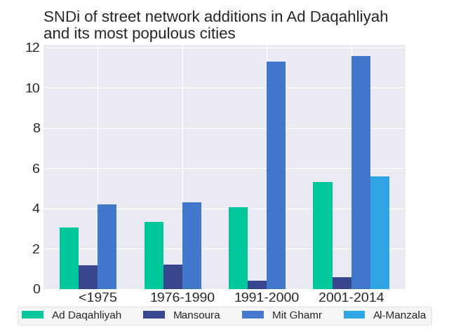
The level of street-network sprawl in new development in Ad Daqahliyah rose steadily. To get a sense of how street development has changed in Ad Daqahliyah, we can consider three of its most populous cities: Mansoura, Mit Ghamr and Al-Manzala. Out of the three cities, Mansoura and Al-Manzala do not follow the same trend as the region. The level of street-network sprawl in new development in Mansoura followed a zig-zag trend with an overall decrease. The level of street-network sprawl in new development in Al-Manzala followed a zig-zag trend.
How do development practices in Ad Daqahliyah fare in comparison to others in Egypt? Most recently in 2001-2014, street construction in Ad Daqahliyah was the 7th-most disconnected out of the 25 regions in Egypt. Its position in the ranks since 1975 has risen; relative to other regions in Egypt, street construction in Ad Daqahliyah has become more disconnected. Ad Daqahliyah ranked 12th in 1975, 13th in 1976-1990, 16th in 1991-2000 and 7th in 2001-2014.
As of 2014, the city with the most disconnected street network in Ad Daqahliyah is Kafr al Sharaqwah with an SNDi of 8.41, which is highly disconnected. Conversely, the most connected city is Dundet with an SNDi of -2.03, which is very well-connected. See trends for these cities: Dundet, Kafr al Sharaqwah
The level of street-network sprawl in the aggregate network in Ad Daqahliyah rose steadily. To get a sense of how the aggregate street network has changed in Ad Daqahliyah, we can consider three of its most populous cities: Mansoura, Mit Ghamr and Al-Manzala. Out of the three cities, Mansoura and Al-Manzala do not follow the same trend as the region. The level of street-network sprawl in the aggregate network in Mansoura peaked in 1991-2000. The level of street-network sprawl in the aggregate network in Al-Manzala followed a zig-zag trend.
To date, Ad Daqahliyah is the 11th-most disconnected out of the 25 regions in Egypt. Its position in the ranks since 1975 has risen; relative to other regions in Egypt, the street network in Ad Daqahliyah has become more disconnected. Ad Daqahliyah ranked 12th in 1975, 13th in 1976-1990, 15th in 1991-2000 and 11th in 2001-2014.